Welcome To Vikarabad District

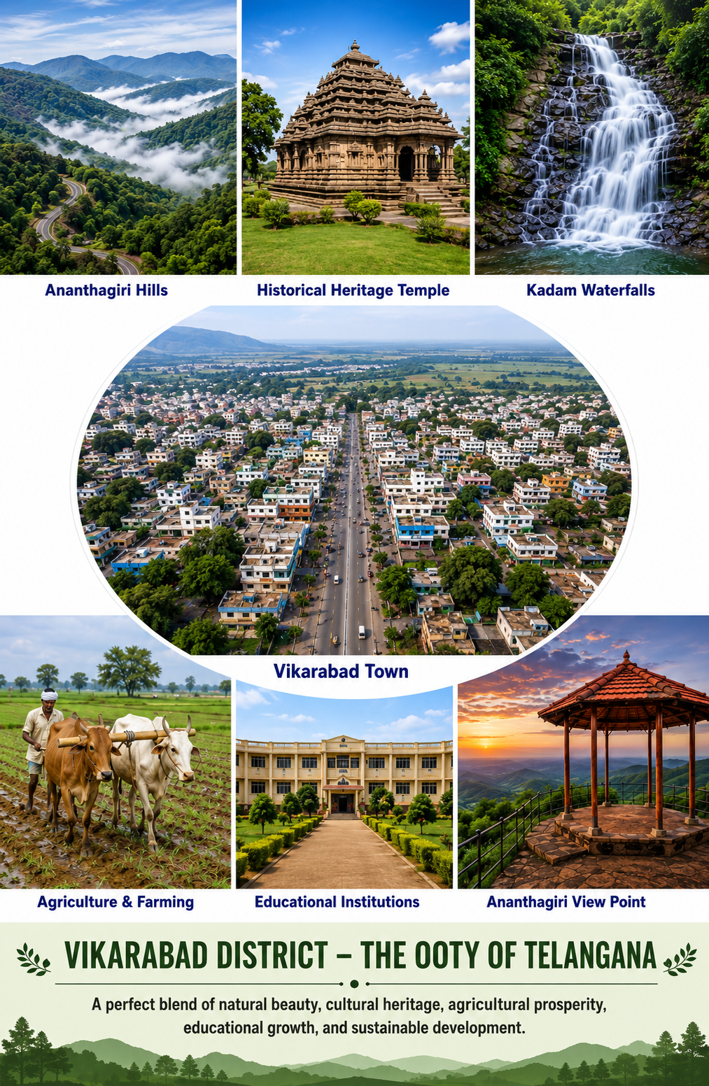
Nestled amidst the scenic landscapes of Telangana, Vikarabad District is a region known for its natural beauty, rich cultural heritage, and historical significance. Popularly referred to as the “Ooty of Telangana,” Vikarabad attracts visitors with its pleasant climate, lush green forests, rolling hills, and tranquil environment. The district serves as an important center for agriculture, education, and tourism, contributing significantly to the development of the state.
Vikarabad District was formed on October 11, 2016, as part of the reorganization of districts in Telangana. The district headquarters is located in Vikarabad town, which enjoys excellent connectivity to Hyderabad and neighboring regions. The district comprises several mandals and villages, each reflecting the traditions, customs, and vibrant lifestyle of rural Telangana.
One of the district’s greatest attractions is the renowned Ananthagiri Hills, a picturesque destination covered with dense forests and breathtaking viewpoints. The hills are a favorite destination for nature lovers, trekkers, and tourists seeking peace away from urban life.
Agriculture forms the backbone of the district’s economy, with farmers cultivating crops such as paddy, maize, cotton, and various horticultural products. The fertile land and favorable climate support agricultural growth and rural livelihoods.
The district holds a special place in Telangana’s journey of development, combining modern progress with cultural preservation. From its scenic landscapes and historical sites to its vibrant communities and economic potential, Vikarabad stands as a symbol of growth, harmony, and opportunity.
Why Connect With Us
Connecting with Vikarabad District Administration provides citizens, visitors, and stakeholders with easy access to important public services, information, and support. Whether you are seeking details about government schemes, public welfare programs, district offices, educational institutions, healthcare facilities, tourism destinations, or development initiatives, our platform serves as a trusted source of information. We strive to keep residents informed about district activities, announcements, and opportunities that contribute to community growth and well-being.Our goal is to strengthen communication between the administration and the public, encouraging participation in the district’s development journey. By connecting with us, you can stay updated on important notices and engage with various government departments more effectively.
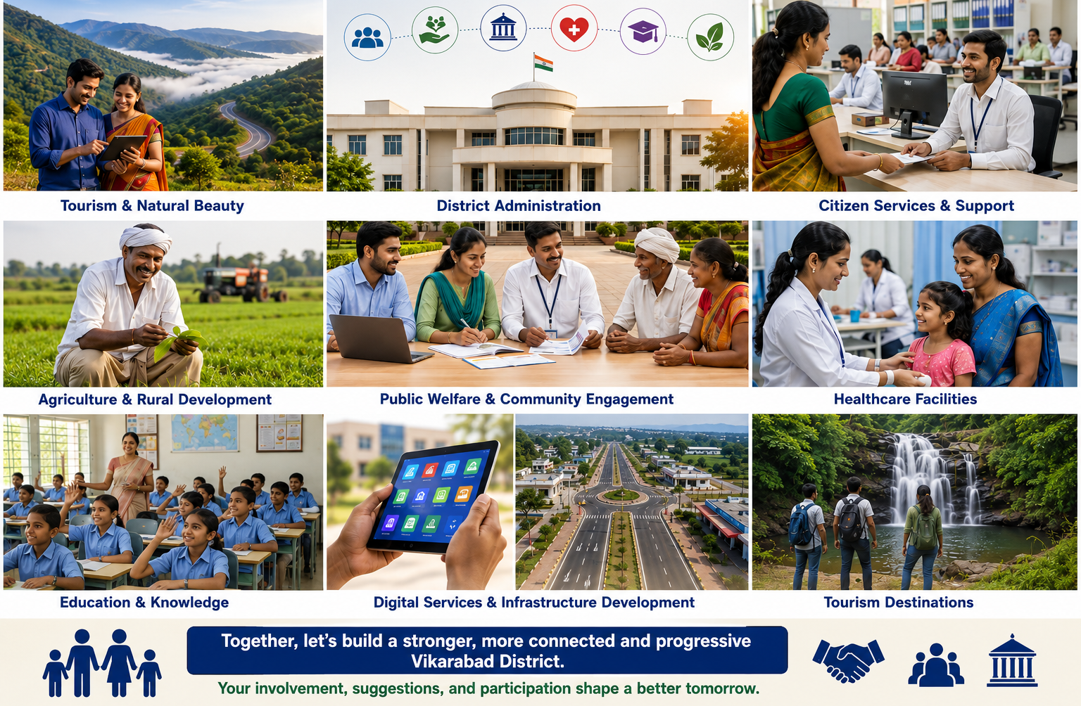
Geography & Location – Vikarabad District
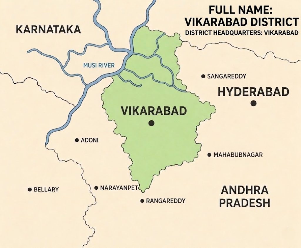
This schematic map of the region, highlights the boundary and location of Vikarabad District, shaded in green, which has its district headquarters in the town of Vikarabad. The map also shows its strategic position in relation to several other districts, the state border of Karnataka, and the state of Andhra Pradesh.
Key geographical points labeled with dots include:
Vikarabad District (green-shaded area with headquarters)
Adjacent districts like Hyderabad, Rangareddy, Sangareddy, and Mahabubnagar.
Nearby major towns such as Narayanpet, Adoni, and Bellary.
The map also depicts the coarse of the Musi River, showing its flow pattern through the area. All text and labels from the map are clearly legible, including the title and headquarters description.The district is home to the scenic Ananthagiri Hills.
Culture, Faith & Festivity of Vikarabad District
Vikarabad District is a culturally rich Telangana where tradition, faith, and community life are deeply connected. The town reflects the heritage of the Vikarabad District, where devotion and cultural values play an important role in everyday life. Temples and religious practices are central to the social fabric, bringing people together.
Festivals are celebrated here with great enthusiasm and devotion. Major occasions such as Sankranti, Ugadi, Vinayaka Chavithi, Sri Rama Navami, and Diwali are observed with rituals, decorations, processions, and family gatherings. During these festivals, the town becomes vibrant with lights, prayers, cultural programs.
A part from festivals, the cultural identity of Vikarabad District is also shaped by its railway heritage and diverse population.Local temple fairs, devotional events, and seasonal celebrations further strengthen community bonds and preserve age-old customs.

Agriculture in Vikarabad District
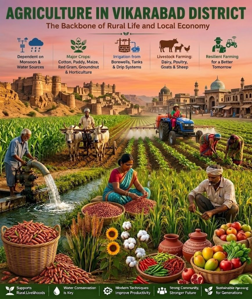
Agriculture plays a vital role in the development of Vikarabad District and serves as the primary source of livelihood for a large section of the population.Farmers cultivate a variety of crops including cotton, paddy, maize, red gram, groundnut, and horticultural produce, supporting both local markets and the regional economy.
The district’s agricultural landscape reflects a blend of traditional farming practices and modern techniques. Irrigation through borewells, tanks, and drip irrigation systems has helped improve productivity and ensure efficient water management. Alongside crop cultivation, dairy farming, poultry, goat rearing, and sheep farming provide additional income opportunities for rural families, strengthening the agricultural economy.
Government initiatives, improved farming technologies, and awareness programs have encouraged sustainable agricultural practices in the district. Farmers are increasingly adopting modern equipment, quality seeds, and scientific methods to enhance crop yields while conserving natural resources.
Agriculture in Vikarabad is more than an occupation—it is a way of life that sustains communities, preserves rural traditions, and drives economic progress. The hard work, dedication, and resilience of the district’s farmers continue to shape a prosperous future for Vikarabad.
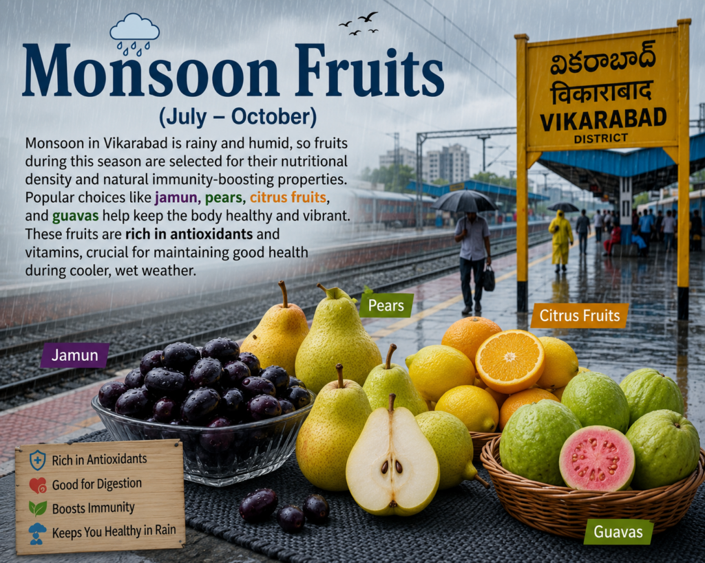
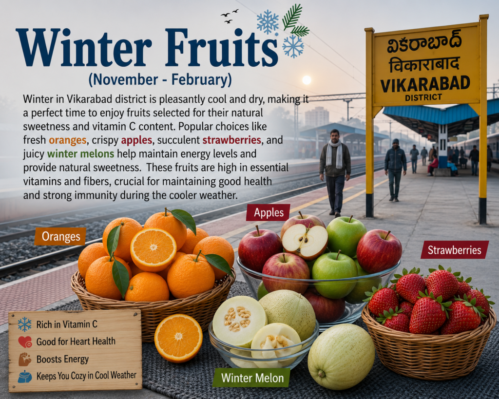
Seasonal Fruits Of Vikarabad District
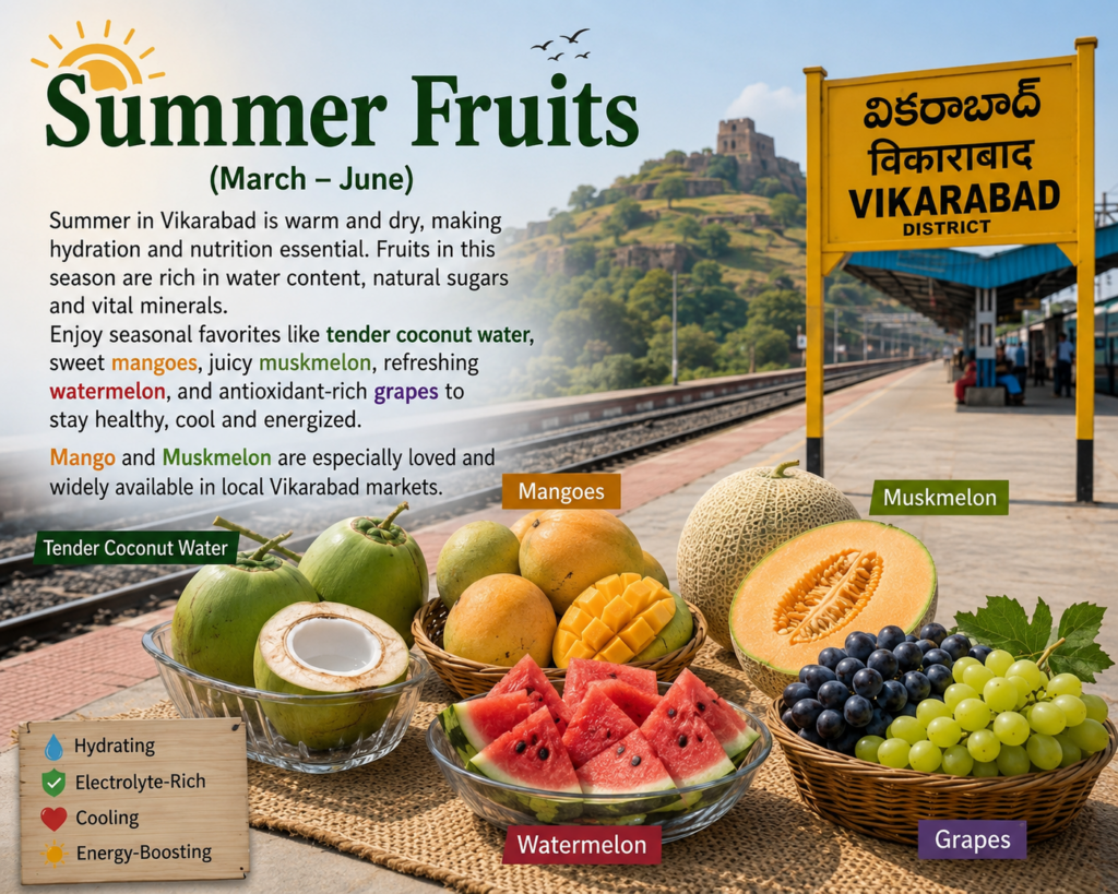
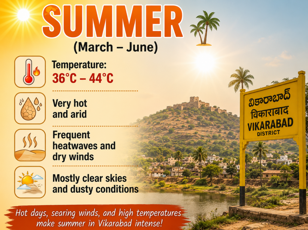
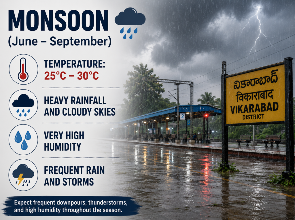
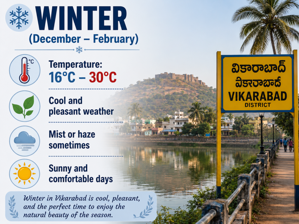
Vikarabad District Weather Overview
Glimpse of Vikarabad District

Area
3,386 sq. km

Population
10,05,205

Languages
Telugu,Urdu

Revenue
₹1,655.06 crore
Vikarabad District Over View
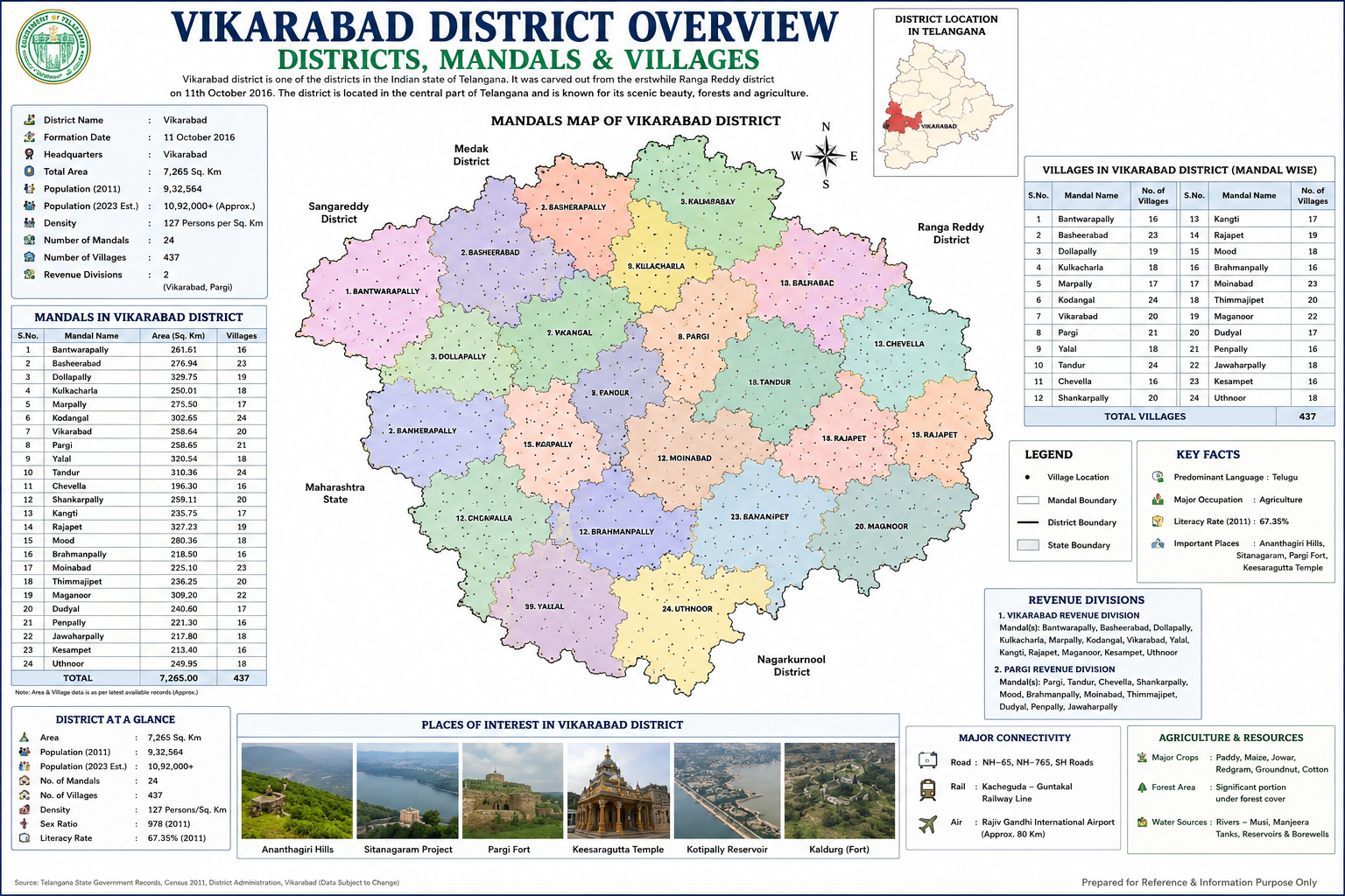
Vikarabad district is an important district in the state of Telangana, known for its scenic landscapes, rich cultural heritage, and agricultural significance. The district was formed on 11 October 2016 during the reorganization of districts in Telangana and was carved out from the erstwhile Ranga Reddy district. Vikarabad town serves as the district headquarters and acts as the administrative and commercial center of the region. Located in the western part of Telangana, the district enjoys a strategic position and shares its boundaries with Sangareddy, Medak, Rangareddy, Nagarkurnool, and neighboring areas.
Covering an area of approximately 7,265 square kilometers, Vikarabad district has a diverse geographical landscape consisting of hills, forests, agricultural fields, reservoirs, and rural settlements. According to available records, the district has a population of over 10 lakh people, with Telugu being the predominant language spoken by the residents. The district has a population density of around 127 persons per square kilometer, reflecting a balanced mix of urban and rural development. Agriculture remains the backbone of the local economy, supporting thousands of farming families across the district.
Administratively, Vikarabad district is divided into 24 mandals and 437 villages, ensuring efficient governance and delivery of public services. The district is further organized into two Revenue Divisions – Vikarabad and Pargi. Mandals such as Vikarabad, Tandur, Pargi, Chevella, Shankarpally, Kodangal, Moinabad, and Marpally play a significant role in the district’s administration and economic activities. These mandals collectively contribute to the district’s agricultural production, educational development, and infrastructure growth.
The district is widely recognized for its natural attractions and ecological importance. Ananthagiri Hills, one of Telangana’s most popular hill destinations, attracts visitors with its dense forests, pleasant climate, trekking trails, and scenic viewpoints. Other notable places include Parigi Fort, Kotipally Reservoir, Kaldurg Fort, and several temples and historical landmarks that showcase the district’s rich heritage. These attractions make Vikarabad a growing destination for tourism and eco-tourism within Telangana.
Agriculture and natural resources play a vital role in the district’s economy. Major crops cultivated in the region include paddy, maize, jowar, red gram, groundnut, and cotton. The district also benefits from significant forest cover and water resources such as rivers, reservoirs, tanks, and borewells, which support both farming and domestic needs. The fertile soil and favorable climatic conditions have helped establish agriculture as the primary occupation for a large section of the population.
Vikarabad enjoys good connectivity through road, rail, and air networks. National Highways and State Highways connect the district to Hyderabad and other major cities of Telangana. The railway network provides convenient transportation for passengers and goods, while the Rajiv Gandhi International Airport in Hyderabad is located within accessible distance, enhancing regional connectivity. With improving infrastructure, educational institutions, healthcare facilities, and government initiatives, Vikarabad district continues to progress as an important administrative, agricultural, and tourism hub in Telangana.
Today, Vikarabad stands as a district that successfully combines natural beauty, historical significance, and developmental potential. Its well-organized administrative structure, rich agricultural resources, tourist attractions, and strategic location contribute significantly to the overall growth of Telangana. The district remains a symbol of balanced development, preserving its cultural heritage while embracing modernization and economic progress.
Mandals in Vikarabad District
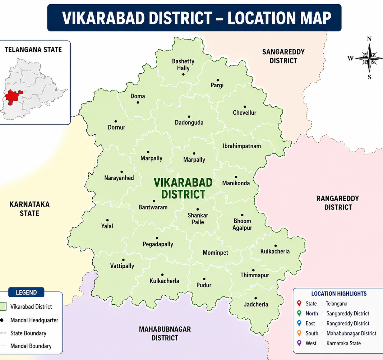
The Vikarabad District Mandal Map provides a detailed view of the district’s administrative divisions and geographic location within Telangana. The map highlights various mandals and their headquarters, helping to understand the district’s administrative structure and regional connectivity.
Vikarabad District is strategically located in the western part of Telangana. It is bordered by Sangareddy District to the north,Rangareddy District to the east,Mahabubnagar District to the south, and Karnataka State to the west. This location makes the district an important link between Telangana and neighboring regions.
The mandal map serves as an essential tool for administration, planning, and development activities. It helps government departments, researchers, and citizens understand the distribution of mandals, local governance units, and regional boundaries, supporting efficient service delivery and district-level planning. The map also assists in implementing welfare programs.
Vikarabad District Population and Chart
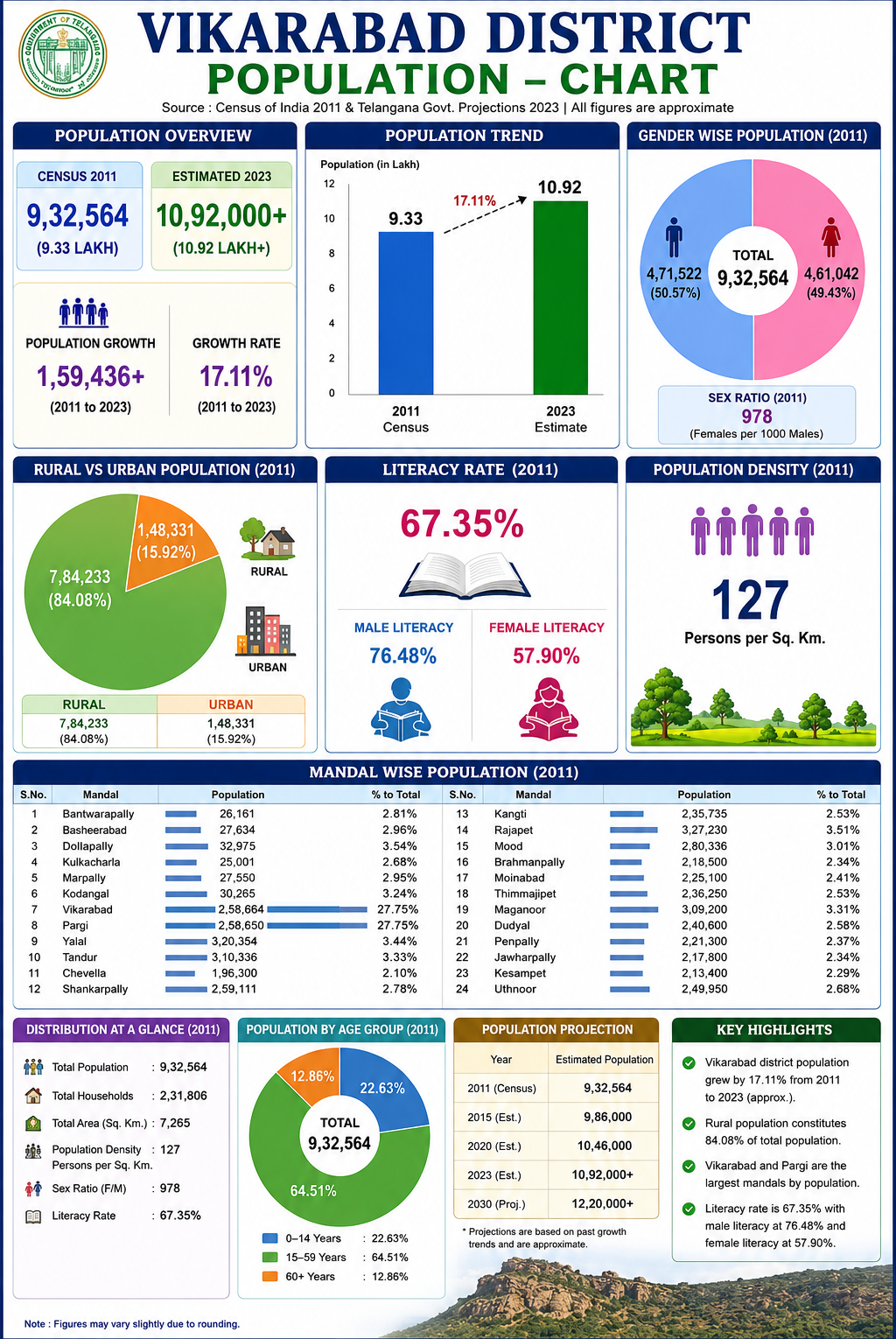
Vikarabad District is one of the important districts of Telangana, known for its rich natural landscapes, agricultural economy, and growing population. According to the Census of 2011, the district had a population of 9,32,564 people. Over the years, improvements in healthcare, education, infrastructure, and economic opportunities have contributed to steady population growth. Recent estimates indicate that the population has crossed 10.92 lakh, reflecting an increase of approximately 17.11 percent.
The district is predominantly rural, with nearly 84 percent of the population living in villages and depending largely on agriculture and allied activities for their livelihood. Urban areas account for around 16 percent of the population and continue to expand due to improved connectivity and development. The literacy rate of the district stands at 67.35 percent, showing significant progress in educational attainment, while efforts continue to improve literacy among women and disadvantaged communities.
The gender composition of the district remains relatively balanced, with a sex ratio of 978 females for every 1,000 males. Population density is about 127 persons per square kilometer, indicating a moderate distribution of people across the district’s geographical area. With a large working-age population and increasing access to education Vikarabad district is steadily moving toward greater social and economic development. The district’s growing population represents both an opportunity and a responsibility, highlighting the need for sustainable planning, employment generation, and improved public infrastructure to support future growth.Vikarabad can achieve balanced growth while preserving its natural beauty and cultural identity.
Vikarabad District Statistics
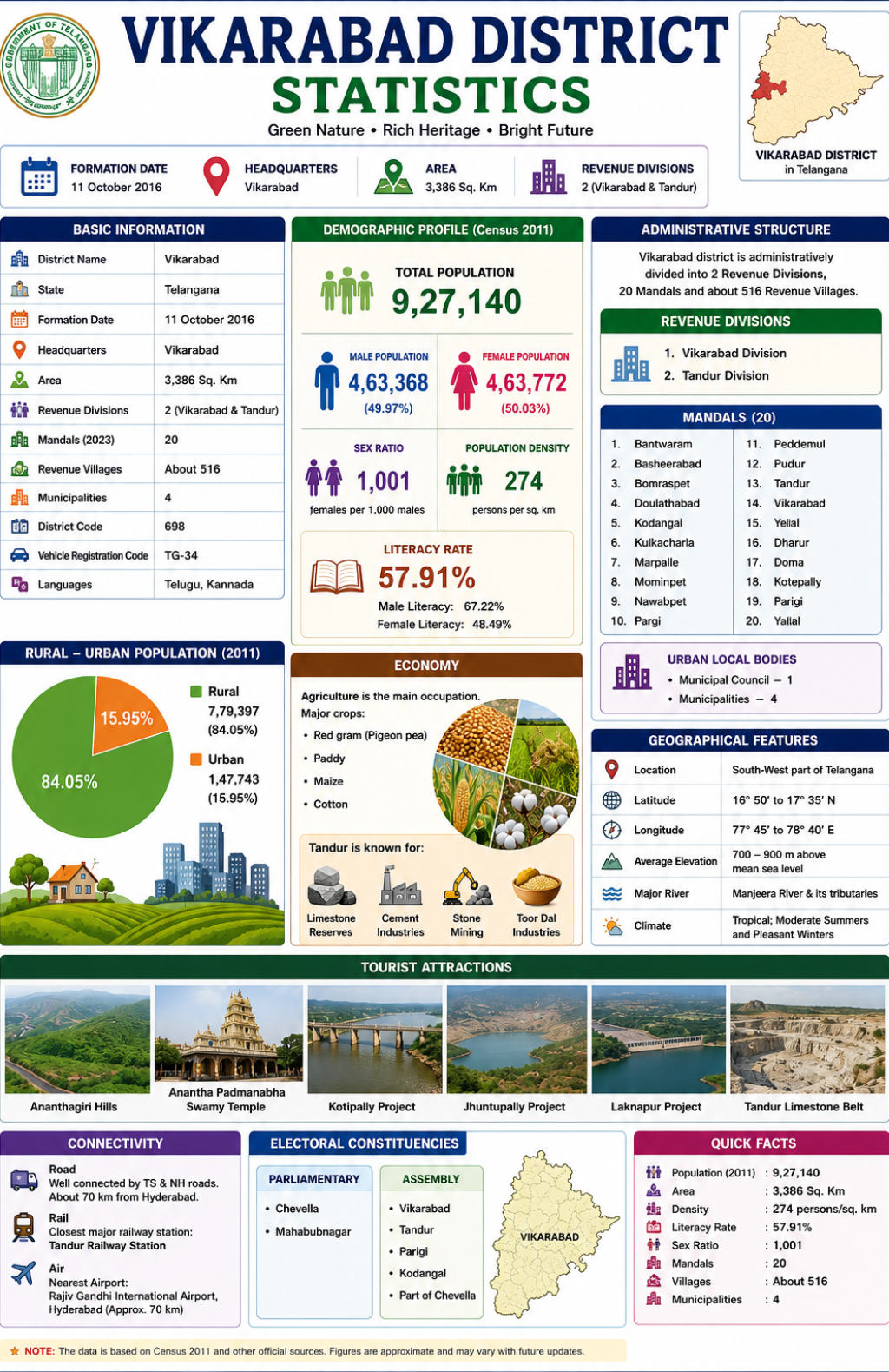
Vikarabad District is one of the important districts of Telangana, known for its natural beauty, agricultural strength, and rich cultural heritage. Formed on 11 October 2016 after the reorganization of districts in Telangana, Vikarabad was carved out of the former Ranga Reddy district. The district headquarters is located at Vikarabad town, which serves as the administrative and economic center of the region. Covering an area of approximately 3,386 square kilometers, the district consists of two revenue divisions and several mandals that contribute to its governance and development.
According to Census 2011, the district had a population of about 9.27 lakh people, with a sex ratio of 1,001 females per 1,000 males and a literacy rate of 57.91 percent. Agriculture is the main occupation, with major crops including paddy, maize, cotton, and red gram. Tandur is well known for its limestone reserves, cement industries, and stone mining activities.At the same time, urban centers such as Vikarabad and Tandur continue to develop through improvements in infrastructure, transportation, healthcare, and educational facilities.
Vikarabad is also a popular tourism destination, famous for the Ananthagiri Hills, Anantha Padmanabha Swamy Temple, Kotipally Project, and Tandur Limestone Belt. With its growing infrastructure, natural resources, and economic potential, the district continues to contribute significantly to the development of Telangana.
With its growing population, strong agricultural foundation, expanding industrial activities, and emerging tourism sector, Vikarabad district continues to play an important role in Telangana’s development. The district’s combination of natural resources, human capital, and improving infrastructure positions it well for sustainable growth and prosperity in the years ahead.
Vikarabad District Measurement
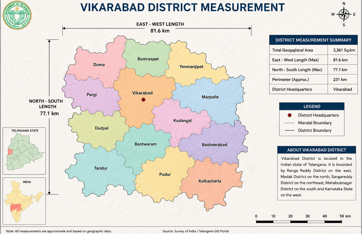
Vikarabad District covers an area of approximately 3,361 sq. km and is an important district in Telangana. The district extends about 81.6 km from east to west and 77.1 km from north to south, with Vikarabad serving as the district headquarters. Comprising several mandals, the district is known for its natural beauty, agricultural activities, and growing infrastructure, making it a significant region for development and administration.Vikarabad District is divided into multiple mandals that support effective administration and local governance. With Vikarabad as the district headquarters, the region serves as an important center for public services, education, healthcare, and rural development. Its well-connected transport network helps strengthen economic and social growth across the district.The district’s measurements and boundaries provide valuable information.
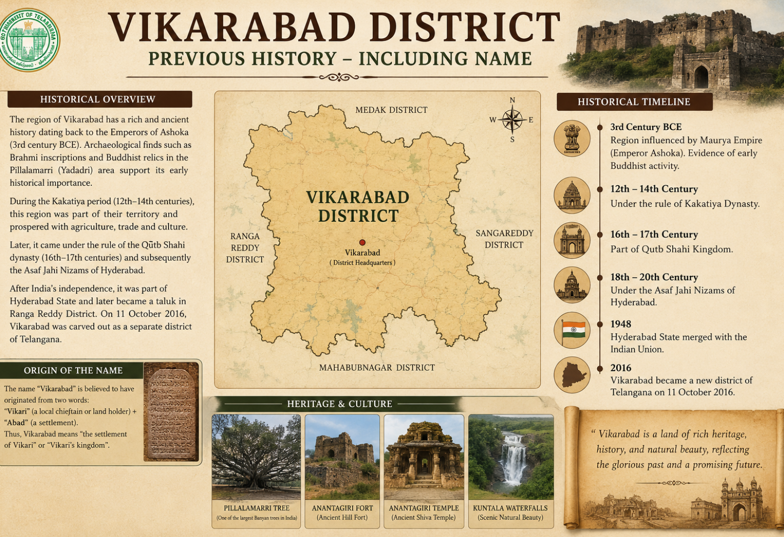
Vikarabad District Previous History Including Name
Vikarabad District has a rich historical background that dates back many centuries. The region was influenced by various dynasties, including the Mauryas, Kakatiyas, Qutb Shahis, and the Nizams of Hyderabad, who contributed to its cultural and administrative.
The name “Vikarabad” is believed to have originated from the words “Vikari” and “Abad.” The term “Abad” means a settlement or town, and together the name is associated with the settlement of Vikari, reflecting the area’s historical identity.
After the integration of Hyderabad State into the Indian Union in 1948, the region became part of Ranga Reddy District. To improve administration and regional development, Vikarabad was officially formed as a separate district of Telangana on 11 October 2016.
Vikarabad District Revenue
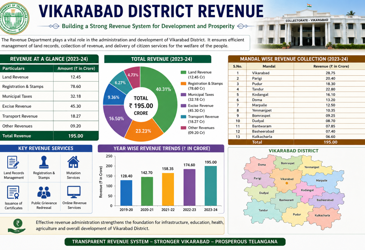
The Revenue Department plays a vital role in the administration and development of Vikarabad District. It is responsible for maintaining land records, collecting government revenue, implementing revenue-related policies, and providing essential services to citizens. Efficient revenue administration supports the district’s overall growth and development.
Revenue collection in Vikarabad District comes from various sources, including land revenue, registration and stamp duties, municipal taxes, transport-related fees, and other government services.
The district’s revenue system helps ensure transparent governance and effective resource management. Through digital services, land record management, certificate issuance the Revenue Department.
Frequently Asked Questions
1. Where is Vikarabad District located?
Vikarabad District is located in the western part of Telangana. It shares boundaries with Sangareddy District in the north, Rangareddy District in the east, Mahabubnagar District in the south, and Karnataka State in the west.
2. When was Vikarabad District formed?
Vikarabad District was officially formed on 11 October 2016 during the reorganization of districts in Telangana. Vikarabad District was officially formed on 11 October 2016 during the reorganization of districts in Telangana.
3.What is the headquarters of Vikarabad District?
The district headquarters is located in the town of Vikarabad.
4.What is the total area of Vikarabad District?
Vikarabad District covers an area of approximately 3,386 square kilometers.
5.What is Vikarabad famous for?
Vikarabad is famous for:
- Ananthagiri Hills
- Anantha Padmanabha Swamy Temple
- Scenic forests and trekking routes
- Tandur limestone industry
- Agriculture and red gram production